
Copyright © Center for Environmental Visualization| ALL RIGHTS RESERVED.
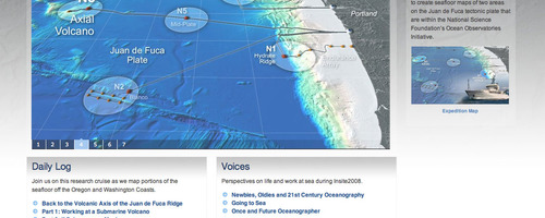
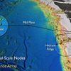
The primary purpose of the Insite '08 Cruise is to map the seafloor in two areas of high scientific interest within the National Science Foundation’s Ocean Observatories Initiative. One area is near Hydrate Ridge, just off the central Oregon coast due west of Newport, Oregon, and the other aea of interest is near Axial Volcano, about 250 miles west of Newport. Existing maps are inadequate for the purposes of safely installing primary nodes on the main cable in the portion of the observatory network known as the Regional Scale Nodes, which is associated with the Juan de Fuca tectonic plate. These nodes will adapt high-voltage power and high-bandwidth communications to levels and formats useable by scientific instrumentation. Installation is likely to begin in 2010.